Books by Tony Cook:
“The Hatfield Lunar Atlas – A Digitally Remastered Edition”
Published: 11th
Dec 2012
Publisher: Springers
No. of pages: 187
1461454980 & 978-1461454984
(from the Springer web site)
Introduction:
The Hatfield Lunar Atlas is a unique resource
for astronomers who study the Moon using a telescope, outdoors using
conventional telescopes e.g. refractors or Newtonian reflectors. It provides
views of the Moon with north towards the bottom as observers see the Moon
through the telescope eyepiece, at least in the Earth’s northern hemisphere.
The Moon is divided into 16 sectors, and from each sector you will find a hand
drawn map with IAU named craters, and then photographic views of these sectors
at different stages in the Moon’s phase. The latter is needed because th lunar
surface changes so much in appearance that it becomes very difficult to
identify craters unless you have a resource like this.
Heritage:
1st edition : Amateur Astronomer’s
Photographic Lunar Atlas - was written by Commander Henry Hatfield and published in 1968. This
was 128 pages long and utilized some telescope photographic views of the Moon,
taken by Commander Hatfield from Seven Oaks, Kent, UK. At the time the
photographs were some of the best available by amateur astronomers, and the
atlas soon became the lunar observer’s bible for finding their way about the
Moon. The atlas was also published around the time of the Apollo missions and
so caught interest of the time.
2nd edition : The Hatfield
Photographic Lunar Atlas –
was edited by Jeremy Cook (my Dad) and was published in 1999. This was 128
pages long and updated some of the names on the Moon with more recent
International Astronomical Union (IAU) names. The coordinate system definition
of N/S/E/W was also IAU based – the previous edition had been Classical with
E-W reversed.
SCT edition : The Hatfield SCT Lunar Atlas – was also edited by Jeremy Cook, and
published in 2005 and was 122 pages along. It was intended though for users of
Schmidt-Cassegrain or Maksutov telescopes e.g. modern Meade or Celestron
telescopes, where a mirror image view of the Moon is produced. These types of
scopes make it especially difficult to navigate the lunar surface where left
and right are reversed. Hence the need for a good atlas that can be taken
outdoors and which represents this unusual geometry. The SCT version of this
atlas fulfilled this role very well. Unfortunately my Dad passed away before he
could see this edition in print
3rd edition : The Hatfileld Lunar
Atlas – A Digitally Remastered Edition – was edited by myself, and has some expanded text, IAU name
updates, and seeks to use modern computer visualisation of the Moon to
digitally augment (add detail) to the original 1960’s era Hatfield photographs.
Selenographic colongitudes were also introduced to supplement Moon’s age data
for each of the photographs. This atlas now has 187 pages.
3rd Edition Chapters:
Chapter
1 – A general introduction to the
atlas, similar to the first pages of the earlier editions, except it explains
Selenographic Colongitude, and also the digital augmentation process which
seeks to enhance the detail seen against the old 1960’s era photographs. Some
handy websites are listed for beginners.
Chapter
2 – This section is intended to
give some very brief observing advice and ideas for studying the Moon to both
the beginner and advanced lunar amateurs
Chapter
3 – This is the main chapter of
this and past editions of the atlas. The Moon is divided into 16 sections.
There is an introductory Full Moon map and plate, just to help you to know your
global geography. Then after this each, section is covered from Map/Plate 1 all
the way through to 16. The maps are hand drawn copies of the originals by
Commander Hatfield, but updated with some new IAU feature names. For each of
the plates associated with each of the 16 sections, you will get at least 5
photographs (digitally augmented) to show how the surface changes with
different illumination. Underneath each photograph is usually a small chart
showing which way the Moon was tilted (librated) because this can have a
dramatic appearance on the aspect ratio and visibility of craters, especially
out towards the lunar limb.
Chapter
4 – Many amateurs now like to
concentrate on the appearance of lunar features during lunar sunrise and
sunset. This is because of the shadow changes involved which make the lunar
surface so spectacular to study. This chapter is entirely a visualisation of
Sunrise and sunset on a set of selected 16 features (roughly one per sector).
Please do not assume that if you cannot find the name of your feature here that
it is not included, as some of the areas visualized cover more than just one
feature. The visualisations are intervals of 3° in selenographic colongitude,
or roughly nearly every 2 hours in Earth time. They may help you to plan when
to observe to see the maximum amount of detail, or help to identify a formation
emerging from shadow that you cannot see on the plates in the previous chapter.
Appendix
1 – This lists the dates and UTs of
Commander Hatfield’s plates, the Sun’s Selenographic Colongitude, the Moon’s
age, the focal ratio used, and where the plates have been used in chapter 3. It
was decided to remove exposure time details and photographic emulsions as these
are not relevant to modern astronomers.
Appendix
2 – Flow charts of what to do in
the unlikely event that you think you see a TLP on the Moon. If you select the
most appropriate flow chart, and follow it, this will help to eliminate most of
the mis-identifications when people claim to have seen TLP in the past.
Appendix
3 – Index of named features – like
the maps in chapter 4, this has been updated with newly named craters by the
IAU. It lists their names, where you can find them on the maps, and coordinate
and size information. Note that not all IAU names have been included, only
features on the nearside that we can see, and which are big enough, and won’t
lead to map clutter.
Where to obtain a copy:
It is really upto you where you wish obtain a copy, I am not allowed to
recommend any, but to be honest, any good book retailer will do. You can take a
look inside,
to see a selection of pages. Note that there is a Kindle (E Book) version of
the atlas available too. If you bring a “paper book” of the atlas along to my
office at Aberystwyth University, or if I am at a conference/meeting, then I’d
be happy to sign it for you for free!
Known Issues:
As with all books and publications, although one seeks to make them as perfect as possible, and does the proof reading several times, mistakes and typos can still occur. I would like to thank readers for pointing things that they have noticed, so that future editions of the atlas can be made even more perfect. Below are some known issues and suggestions for improvements:
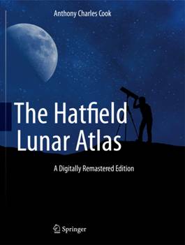
Front Cover – some commented that in the picture, the mount between the
telescope and the tripod looks a bit flimsy.
Plate 1e – the top and bottom images should be switched.
Plate 9f – Map location “9b”, in the lowest caption, should read “9 b3”.
If there is an opportunity in future for a revised edition, then these
will certainly be amended.
Institute
of Maths and Physical Sciences
Institute
of Mathematical and Physical Sciences
The
University of Aberystwyth